2016-10-13 Warburton
Warburton, the village and the church was a talk with many illustrations given by Dr Michael Nevell to the group
which told of the surprise, enjoyment, frustration and very considerable time over many years with volunteers to
establish the history of the village of Warburton.
It included the ‘invasion’ of houses to part demolish them to get at the underlying fabric and story of construction
and decoration, including the farms and removal of items from their original place for ‘convenience’ but leaving
tell tale modern coins beneath the structures.
History is not always what you see at first, but needs verification and proof.
A good evening was enjoyed and some bought Dr Nevell’s book, noted below which gives greater detail of our past knowledge.
Some photographs are reproduced below with the very short wikipedia summary.
Dr Nevell's sumary of his talk.
Warburton lies in an ancient landscape, on the border of East Cheshire and Trafford,
Greater Manchester, in North West England. Today it is best known for the busy toll-bridge
that crosses the now dry river bed of the Mersey, and its two parish churches. Warburton
hides a rich landscape history with origins in the late prehistoric and Roman periods.
My talk reviewed 19 years of archaeological and historical investigation in Warburton covering
development of the landscape and village, the archaeology and history of the old church
(one of only 29 medieval timber churches and chapels in England and Wales), the buildings
of the area, and a study of the people of the parish from 1600 to 1900 using the manorial
and probate documents. Archaeology highlights ranged from a Roman coinhoard, through the
medieval church which was also the site of priory, to the 24 surviving timber-framed buildings
in the township and a surviving Tudor wall painting in one of the farms. The survey work at
Warburton provides a detailed record of a rural community on the edge of the great industrial
and social changes of the post-medieval period.
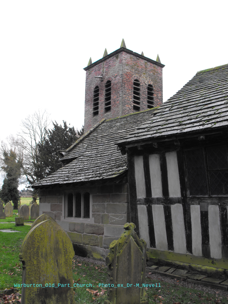
The photograph below of old part of the church is coutesy of Dr Nevell.

Old part of church.
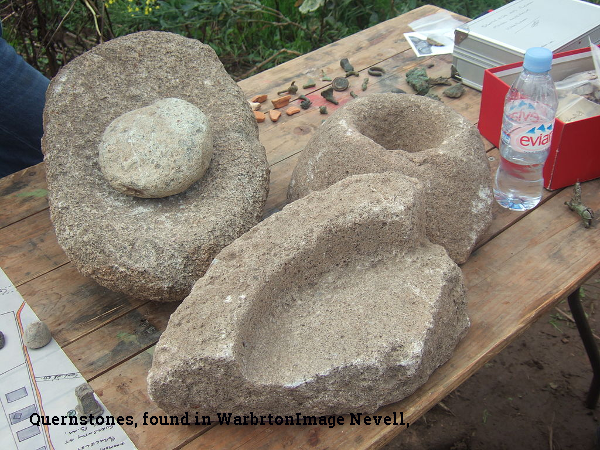
Quernstones.

Warning!
The rich archaeological and historical landscape of Warburton is currently threatened
by 21st century development in the form of the proposed high-speed railway line from
Birmingham to Manchester. A feeder line is projected to cut across this rural township
from north to south, potentially altering its character permanently. Such threats to the
landscape of Warburton are not new.
Book on Warburton.
The book is on sale from Salford University shop for Ten pounds plus postage £2.50.
http://shop.salford.ac.uk
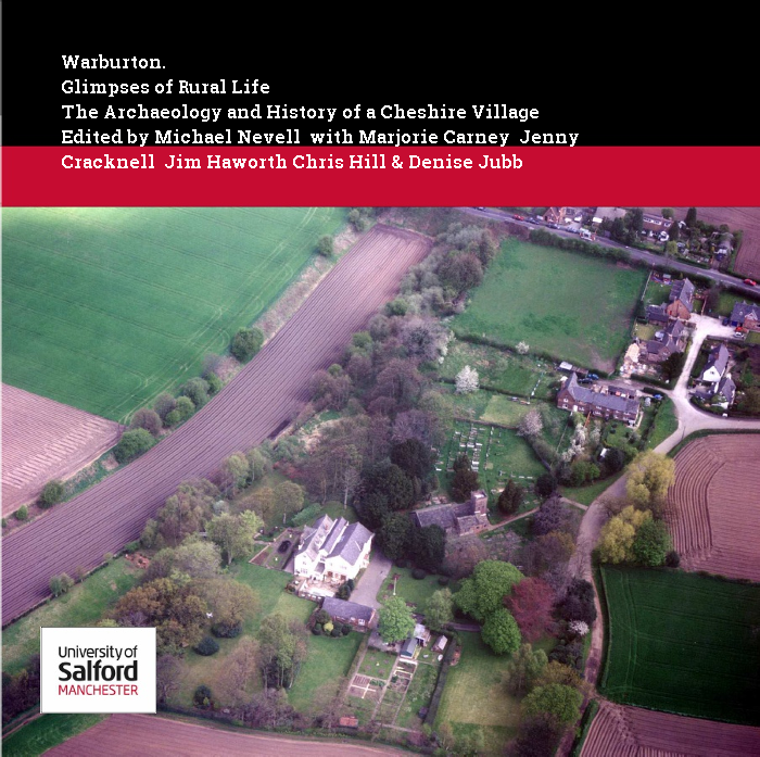
WARBURTON Glimpses of Rural Life
The Archaeology and History of a Cheshire Village
Edited by Michael Nevell with Marjorie Carney Jenny Cracknell Jim Haworth Chris Hill & Denise Jubb
© University of Salford and the authors 2015
ISBN 978-0-9565947-8 5 e-book version ISBN 978-0-9565947-9-2
University of Salford Archaeological Monographs Volume 4
First published by the Centre for Applied Archaeology, School of the Built Environment, University of Salford.
Extract from book:
Some limited evidence has been found of activity on the site of Warburton dating from the Bronze Age, through the Iron Age and Roman periods; these include a flint blade, six Mesolithic tools, pieces of quernstone, and a snake bracelet. Archaeological evidence indicates that the area around Warburton has been used agriculturally since at least the Roman times. In the Domesday Book, the name was Warburgtune which name has evolved to today's 'Warburton'. The suffix –ton means a settlement or farmstead in Old English, indicating that the settlement has pre-Conquest origins. It has been suggested that Warburton was the site of an Anglo-Saxon burgh or defended settlement, possibly either called "Toppingburgh" or Weard byrig, established by Aethelflaed, Queen of the Mercians, in 915 during the wars with the Vikings. However, it now seems likely that site lay on the Wales–Cheshire border.
The first documented reference to Warburton occurs in the Domesday Book, where the two manors of Warburton were recorded; the manors were united by the late 12th century. Before the Norman conquest, the area was controlled by the Anglo-Saxon thegn Aelfward. Although the Domesday Book records no church in Warburton, it is possible that the church dedicated to Saint Werburgh is pre-Conquest. The omission of the church may not be significant, as not all pre-Conquest churches or chapels were recorded in the Domesday survey. The first documented evidence of a church in Warburton was in a deed of 1187, when it was a chapel of ease for the parish of Lymm. Warburton became a separate parish in the 13th century. The church is surrounded by a ditch and bank, probably dating to at least the 14th century. Warburton is also the site of a medieval priory, near the Church of St Werburgh; although the priory was only formed in the 13th century, it was dissolved in 1270.
Warburton was predominantly a farming village during the medieval period. The north western corner of the township was used as a deer park. Warburton grew as an agricultural town during the medieval period, and it remained almost untouched by the Industrial Revolution; this is reflected in the population change between 1801 and 1901, dropping from 466 to 403, with little variation at a time when the rest of Trafford was expanding rapidly.
Annual Archeology Event.
The University also runs a “Greater Manchester Archaeology Day”, which this year it is on Saturday 26Th November Link below:
http://shop.salford.ac.uk/browse/extra_info.asp?compid=1&modid=1&catid=225&prodid=2299.
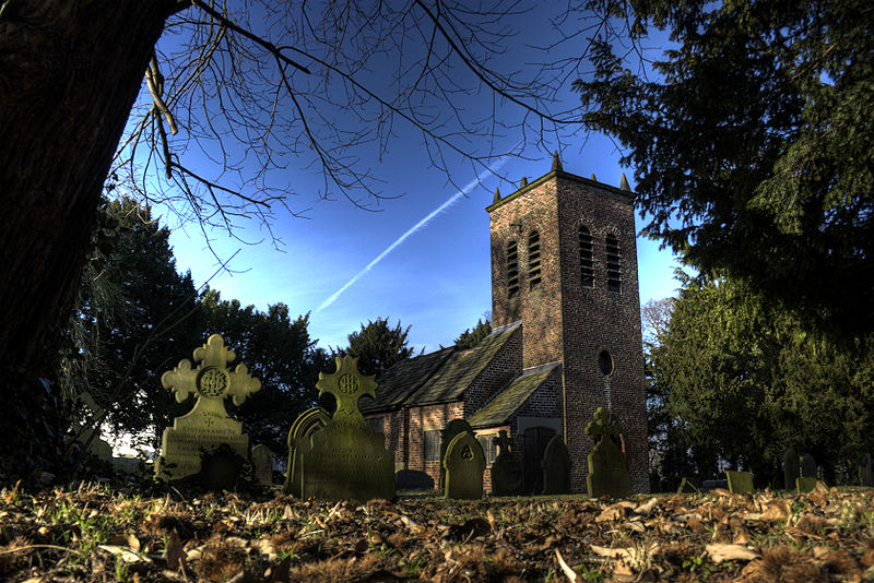
The Church.
Photo: Description. St Werburgh's parish church, Wigsey Lane, Warburton, Greater Manchester.This view is taken the wall beside the road.
Date 27 December 2008 Source Own work by Author: Parrot of Doom. Licence: CCbySA

Links:
wikipedia:
https://en.wikipedia.org/wiki/Warburton,_Greater_Manchester
